>>2378560To answer your question on the quality of roads, I’ll use this separate post so I’ve got enough room to comment in detail.
Great Central Road: frequented by tourists, Aboriginal community members, road trains, staff travelling between communities. Condition: pretty good. Frequently graded by contractors.
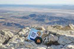
Warburton-Blackstone Rd (pictured) see mid right of map, used by road trains, some mining vehicles and some local (Aboriginal) people but closed to tourists. Condition: a bit rough.
Gunbarrel Highway: famous 4WD track, semi-popular with tourists. Most sections are closed due to ongoing COVID travel restrictions in the area. Condition: very rough with the rare small sections that cross over into existing sections of Great Central Rd near Giles.
Connie Sue Highway: even more rough than the Gunbarrel Highway. Punishing on vehicles. Currently closed to the public.
Not listed on map: Aboriginal Business Road. An unlisted, extremely restricted use road near the WA-SA border that goes south from Blackstone down to the Irlkurka Roadhouse (not listed on map, as it is beyond the area depicted).
This road is closed to all traffic except for Aboriginal Business (that is their name for ceremonial activities and funeral activities).
This road fascinates me because of the total lack of information available online. Almost no photos or videos of this region are online.

