Quoted By:
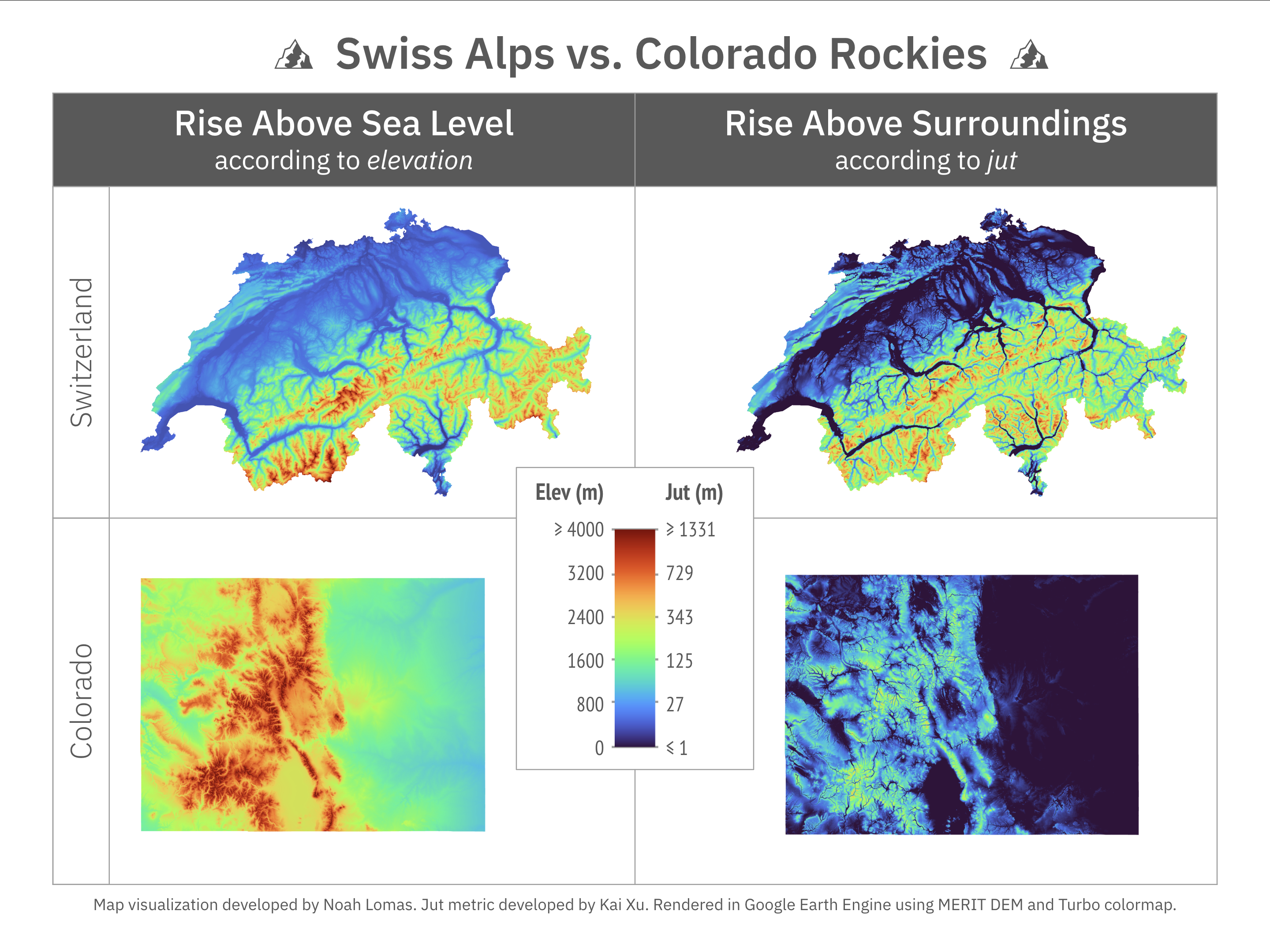
Topographic prominence and topographic relief are two completely separate ideas, and the difference is very important in mountaineering. Every western US state has multiple spots that have more then 2,000m (6600 ft) of topographic relief within 11 miles (10 nautical miles or 17.8 km), Colorado's case it has a location that gains/drops more than 2500m within that distance. Idaho hold the US record by having locations that drop 2500m in less than 6 miles (5.21 NM or 10 km). Every single western US state has dozens of 5.13+ routes in various locations (most of them aren't even at high elevation, the average is right around 2,000-3,000m). Colorado state alone has about 40-50% (about 40,000 sq miles, 103,600 sq km) of the FAA definition hazardous mountainous area (3k ft in 10 NM) as the entire multinational European Alps.